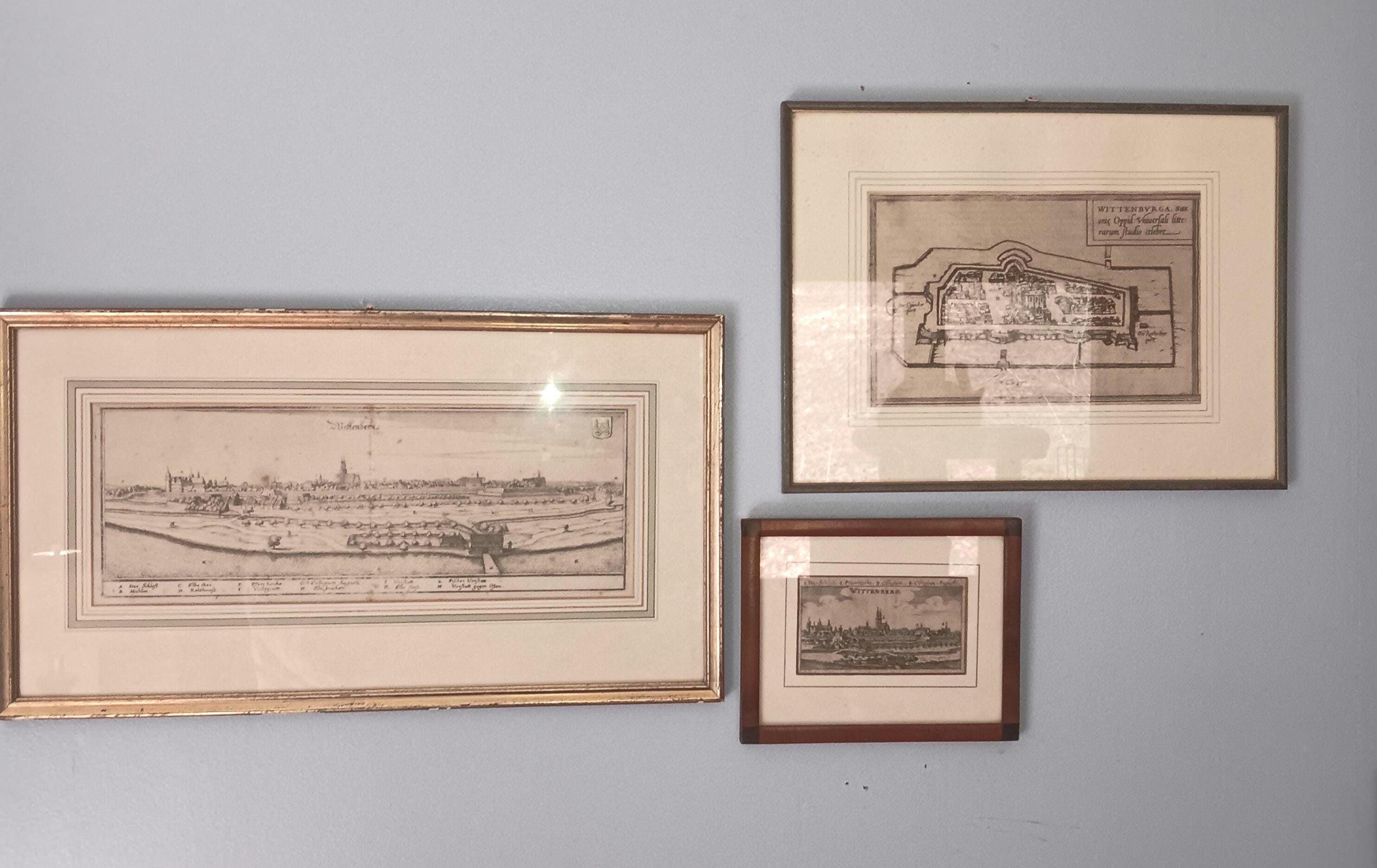
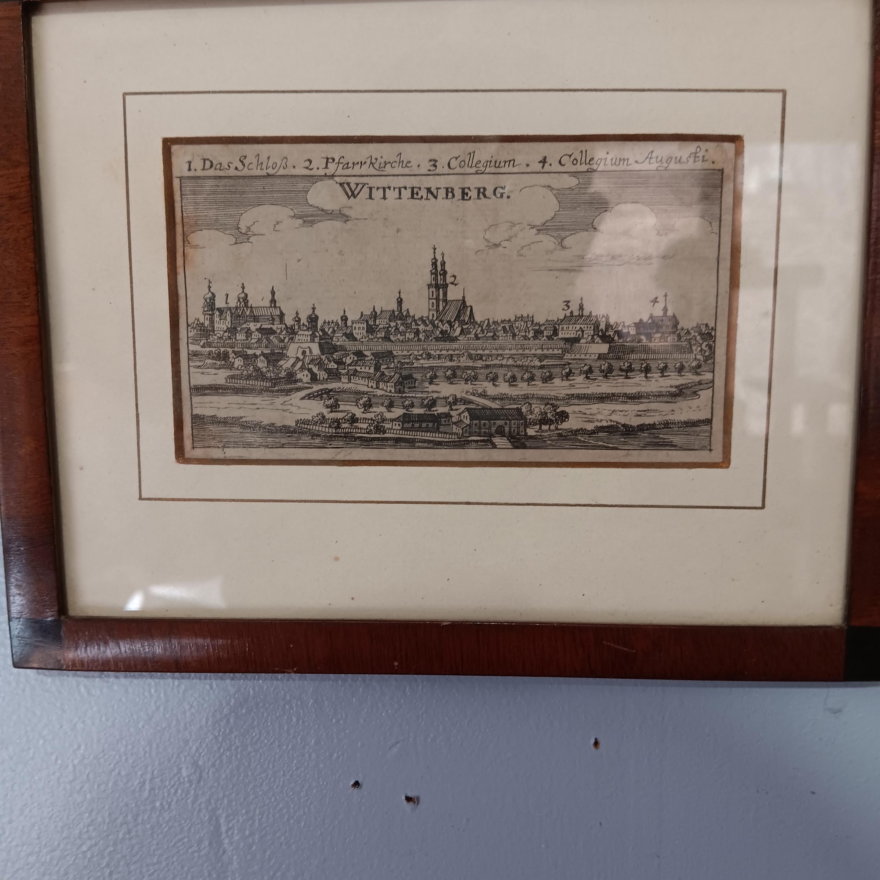
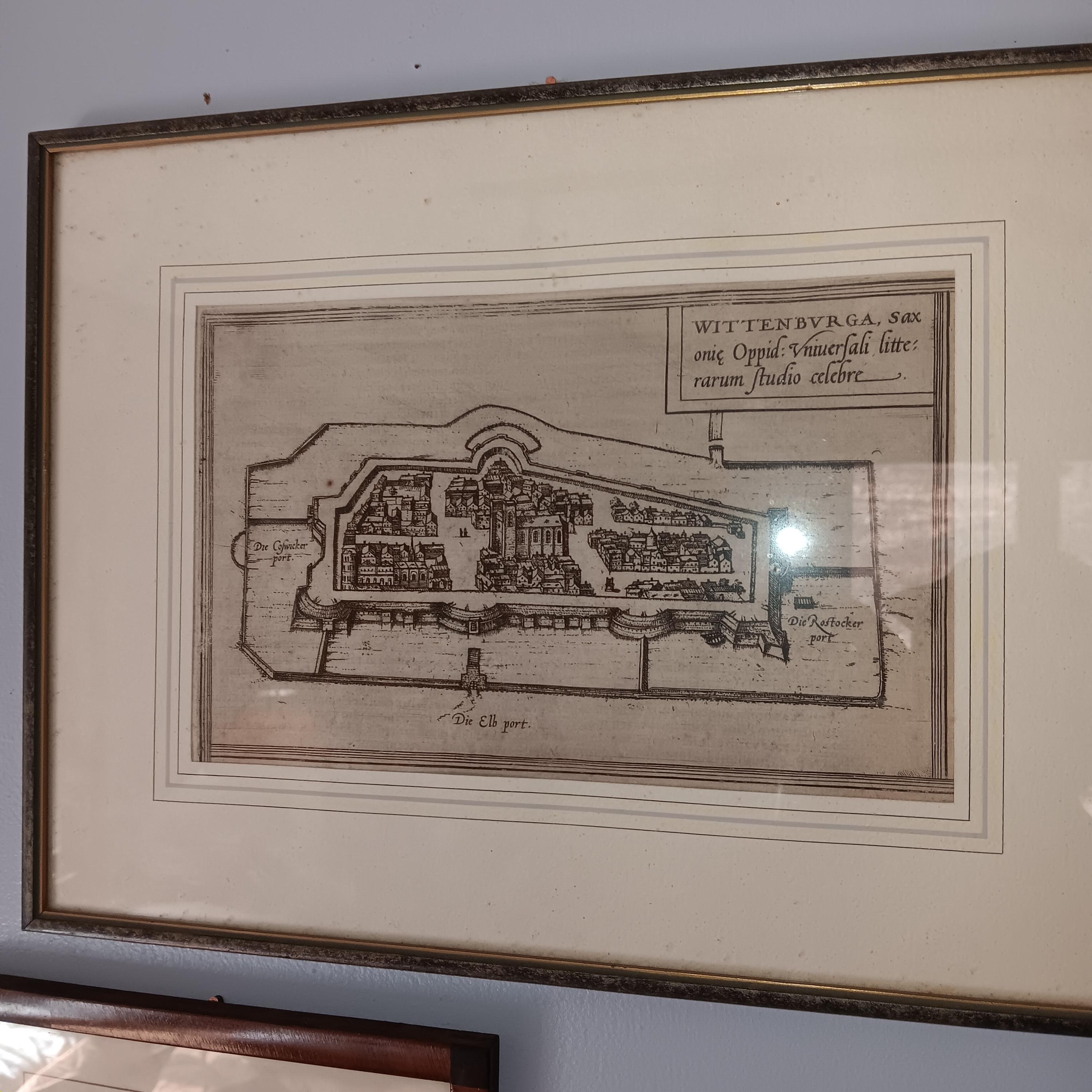
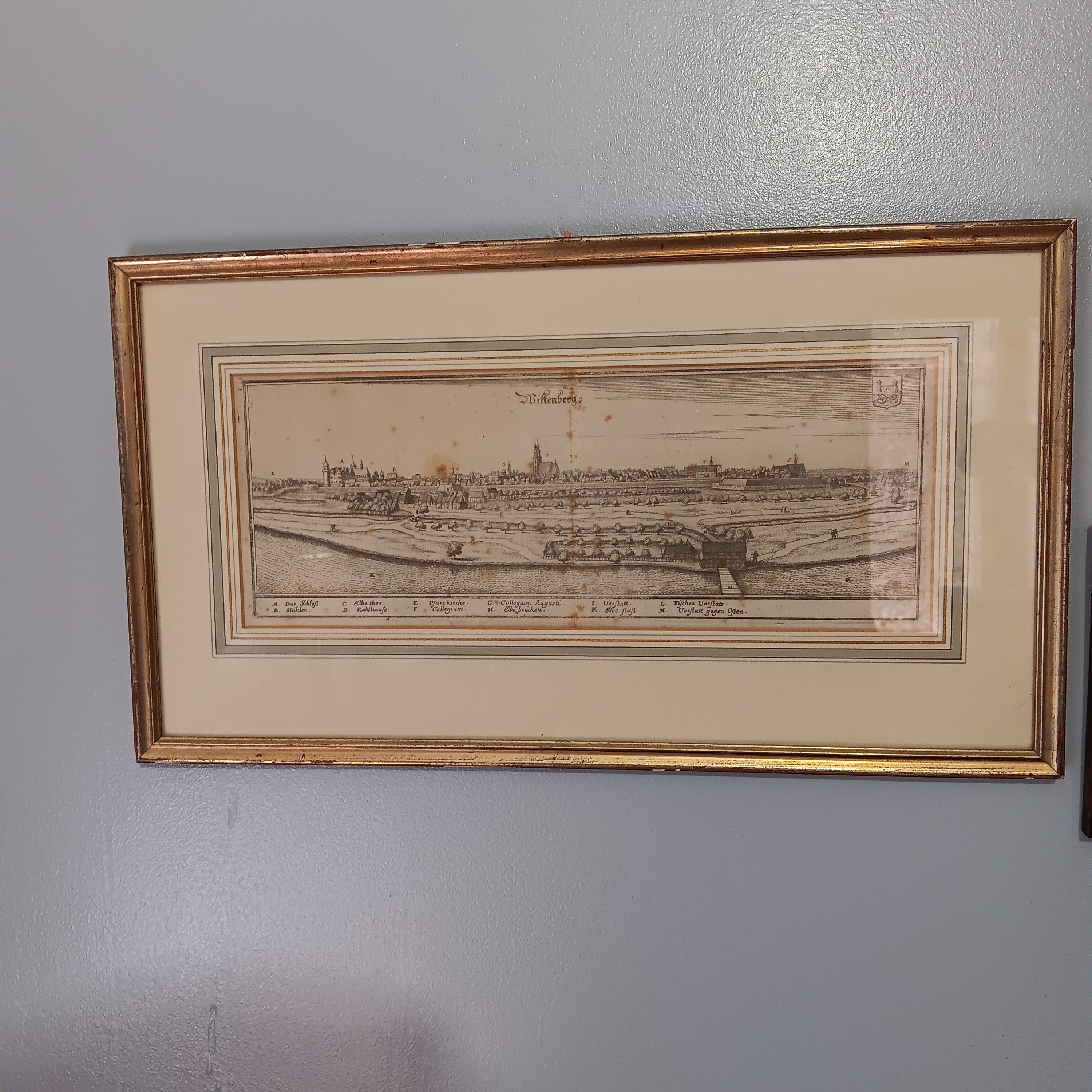
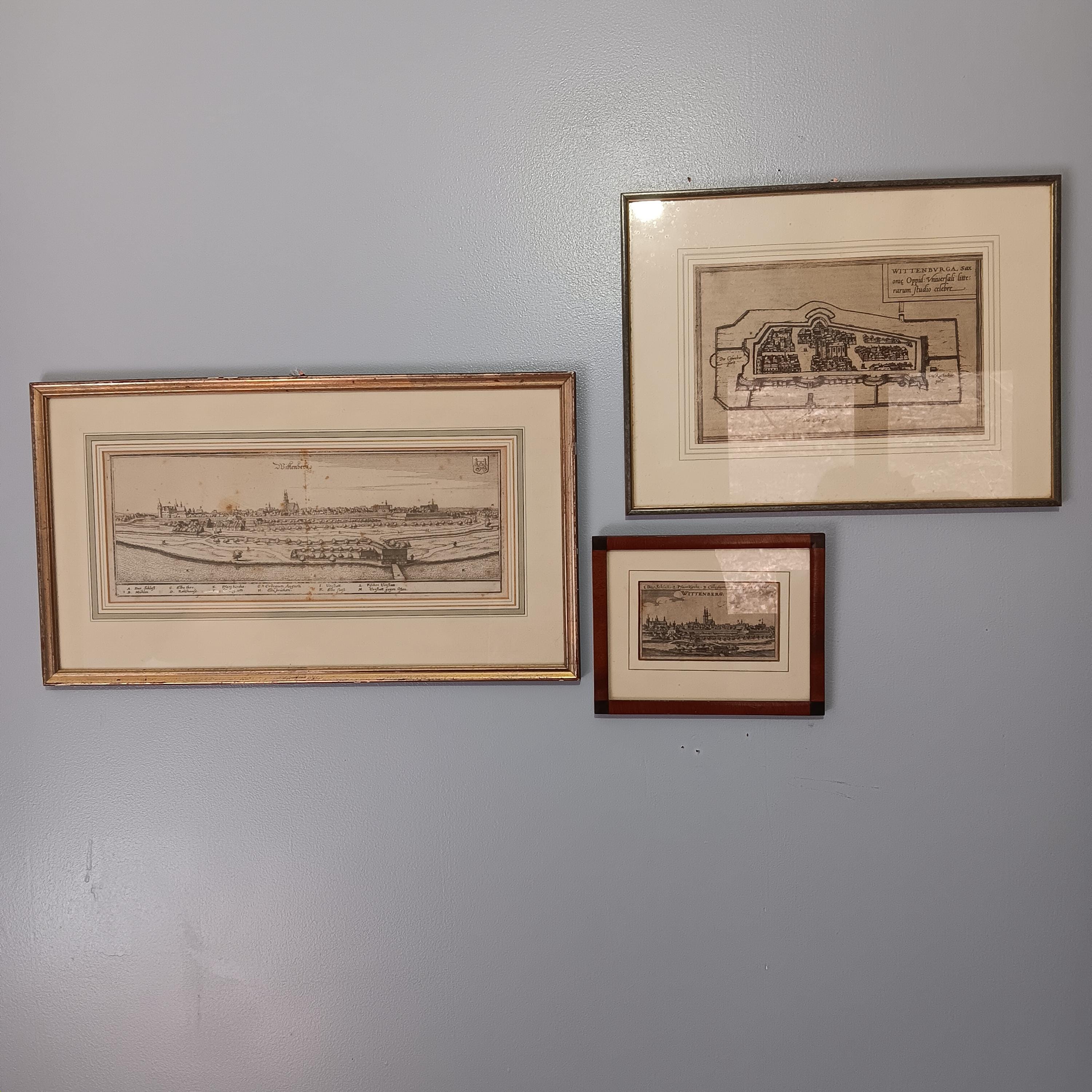
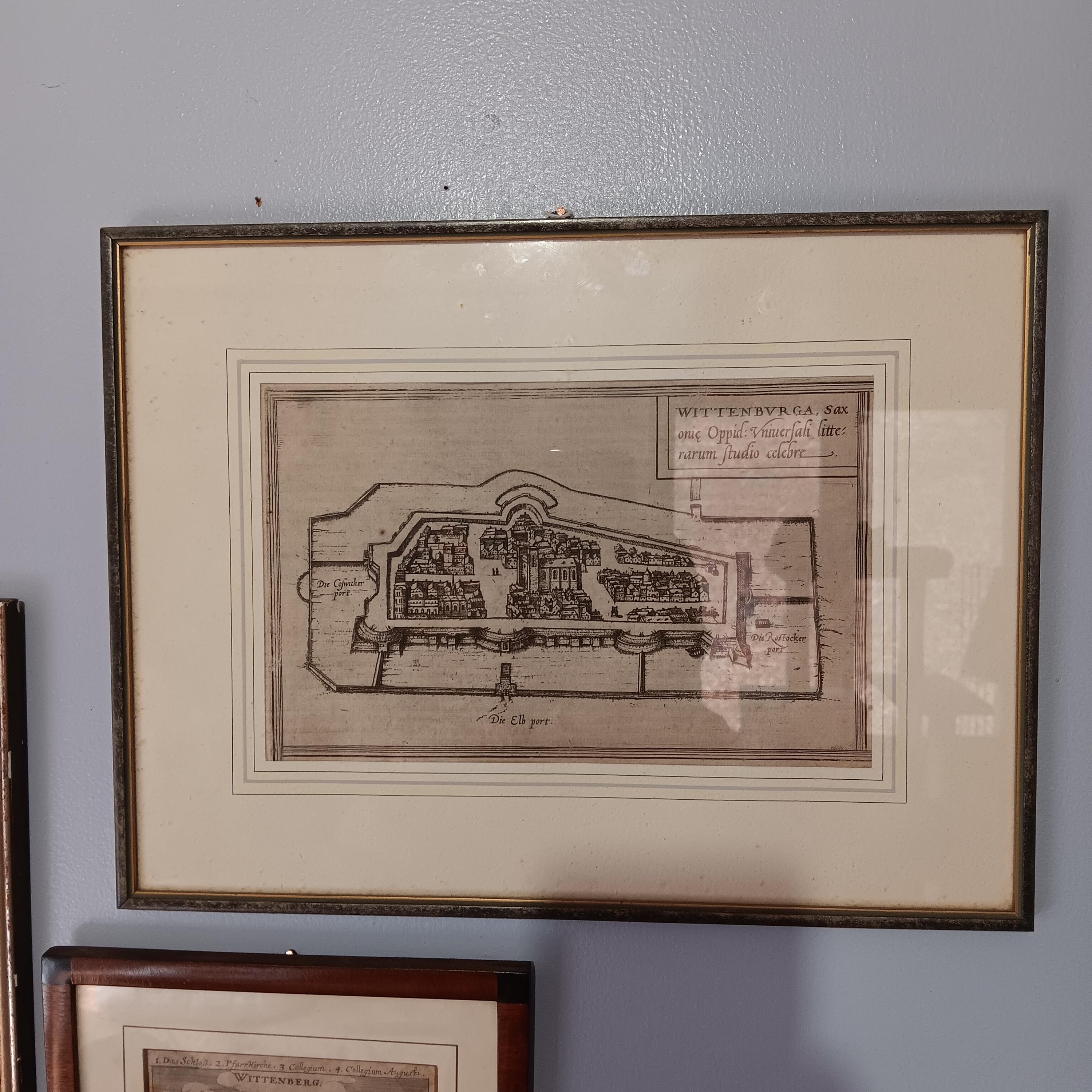
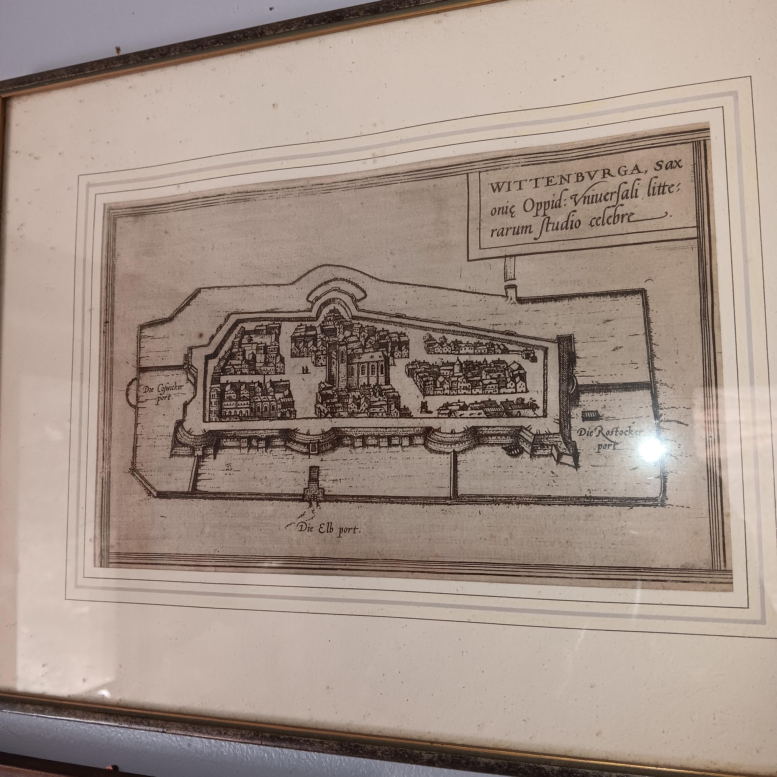
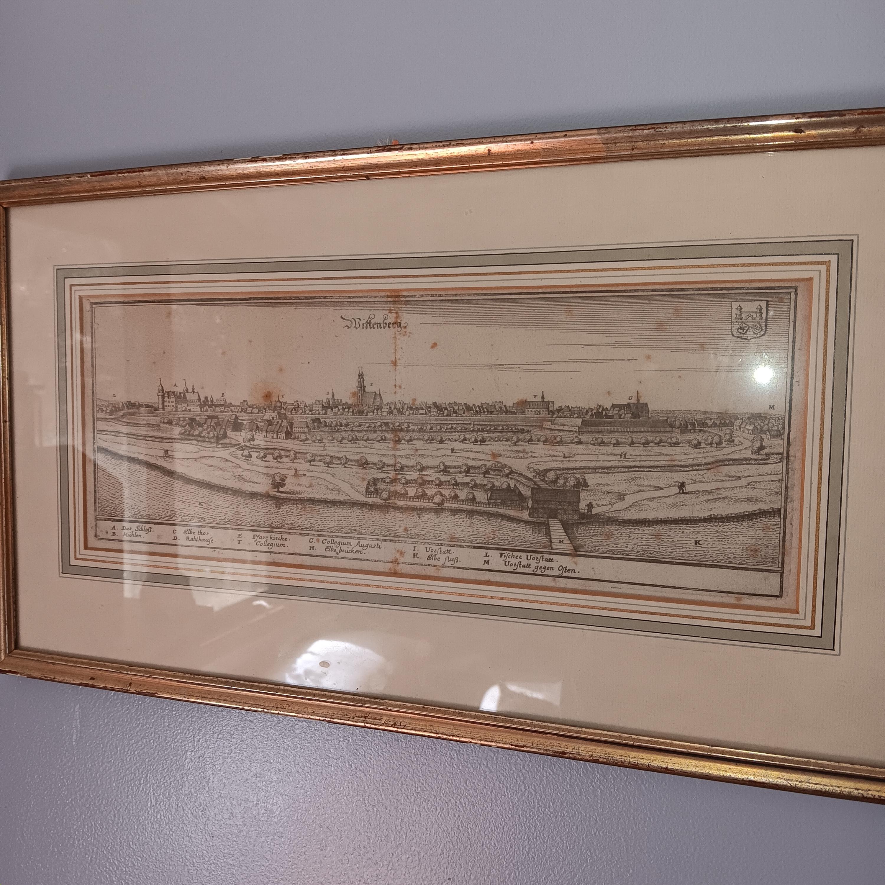
16th Century Maps Wittenberg Germany Collection of Three Original 1575-1600
$159.95
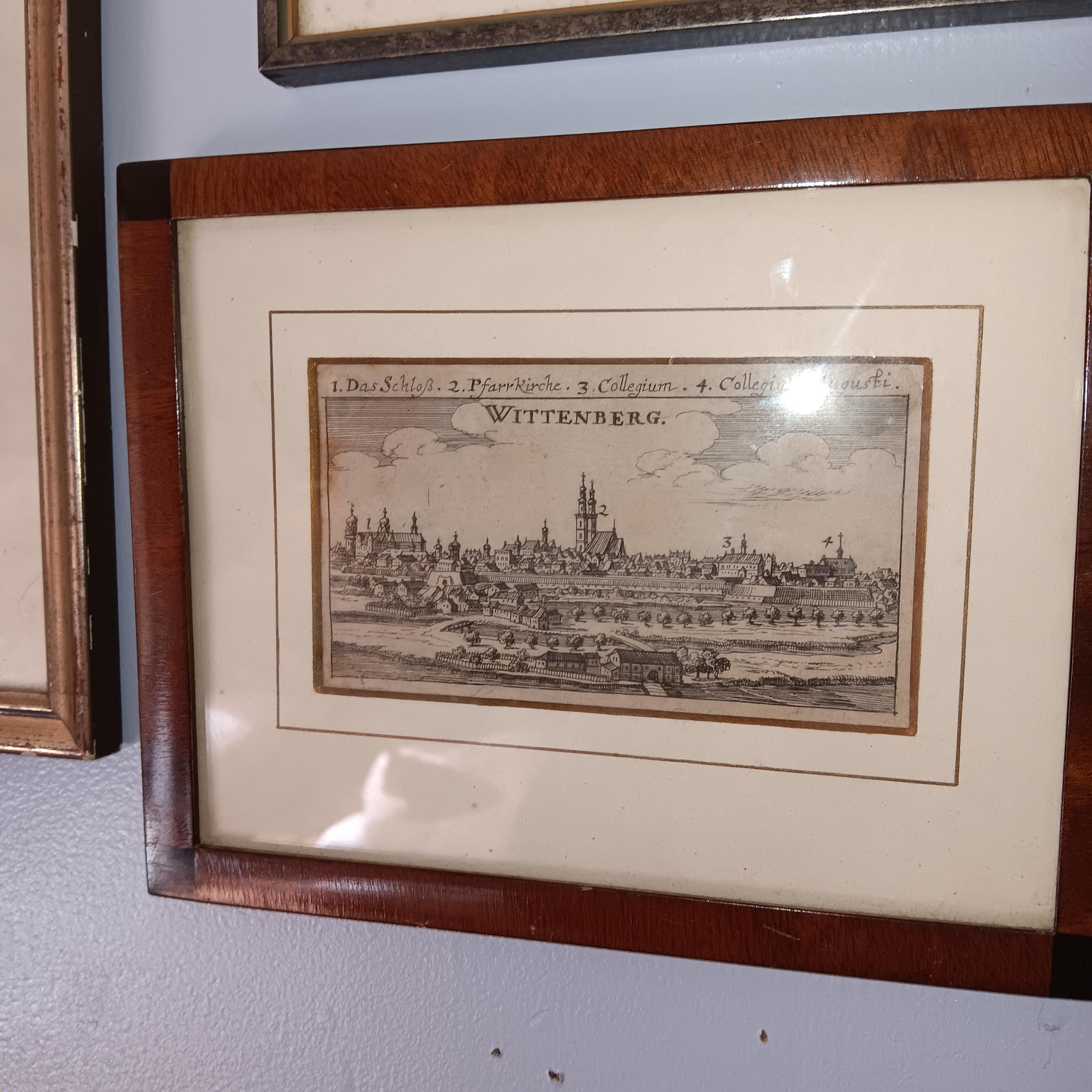
Three very early maps of Wittenberg, Germany, all copper plate prints, from circa 1575 to early 1600s. Cityscape of Wittenberg with city crest at top right. Frame is 10.5” by 14” map is 6” by 9.25”. Bird’s eye view of Wittenberg displaying protective moat and walls. Frame is 6” by 7.75” map is 2.75” by 4.5”. Engraved cityscape detailing four Church spires. Light foxing, as would be expected, but framed on acid-free mattes. Among the earliest city views ever published, highlighting the site of the birthplace of the Protestant Reformation and Wittenberg as a center of learning during the Enlightenment.
Shipping from United States
Processing time
1-3 business days
Customs and import taxes
Buyers are responsible for any customs and import taxes that may apply. I'm not responsible for delays due to customs.
Payment Options
Returns & Exchanges
Returns & exchanges not accepted
But please contact me if you have problems with your order